
Hosted by Michael Kauffmann
Podcast Episode Summary
What happens when geology, wildflowers, fire, cultural history, and conservation all converge in one remarkable California landscape?
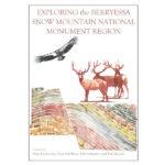
In this episode of The Backcountry Beat, Michael Kauffmann sits down with authors Marc Hoshovsky and Bob Schneider to explore the Berryessa Snow Mountain region and the story behind their book, Exploring the Berryessa Region: A Geology, Nature, and History Guide.
Their conversation ranges widely across this fascinating corner of Northern California—from exposed tectonic boundaries and unusual soils to Native American history, fire-adapted forests, wildlife corridors, and the long effort to protect Berryessa Snow Mountain National Monument.
Marc and Bob also share the story of how the book grew from geology field trips into a much broader guide to the landscape. Its mile-by-mile road guides weave together geology, ecology, history, and recreation, giving travelers a deeper understanding of what they are seeing along the way.
Along the journey, they highlight some favorite places to explore, including Molok Luyuk and Bear Valley, the Highway 16–20 corridor toward Clear Lake, and the road from Stonyford toward Snow Mountain.
But the conversation ultimately returns to something larger than any single destination: we care for places differently once we know them.
The hope behind both the book and this conversation is simple—get out there. Follow the roads and trails. Look closely at the rocks, plants, rivers, and evidence of those who have lived on and cared for this land for thousands of years. Build your own relationship with this remarkable region.
Because experiencing a landscape is often the first step toward becoming its steward.
Exploring Berryessa with Marc Hoshovsky and Bob Schneider
Backcountry Press 00:08
Mark and Bob, welcome to the backcountry beat. I’m excited to explore the Berryessa region with you today, and my plan is to just kind of give each of you a chance to answer a few questions here. And if one of you wants to jump in and and share more at the end of another’s response, that would be great. But let’s start with Mark, and with kind of the big picture here, what makes the Berryessa region such a special place and a distinctive part of California?
Marc Hoshovsky 00:46
Well, this this region is fascinating, both from from multiple perspectives, from the the geological point of view, but also ecology and history. The geology is so fascinating that geologists from all over the world fly in here to study some of the processes that are really exposed here directly on land. Amazing things are the the tectonics that you have here. You can drive across tectonic plate boundaries, which is unusual. I mean, usually as tectonic boundaries are down deep under the ocean, you can drive across them here. You can see the results of what’s essentially a tectonic rock factory. So many different types of rocks that have been developed over 170 million years, and I have actually been leading some walks out some of the creeks at the in the Coast Range, and I can ask people, my participants, to pick up about eight different rocks, and from those rocks, I can tell them the history, the geological history of Central California, right there from the evidence I have there. So it’s just amazing. the The Great Valley Group, which forms the eastern part of the region is the longest continuous sedimentary record of in in North America, and some of the rocks that you find here have been brought up from 12 to 18 miles deep, where they were highly metamorphosed. You can see these rocks on the surface. Just gives you a sense of the dynamic nature of the
Backcountry Press 02:25
Earth. Awesome.
Robert Schneider 02:27
I’ll add Michael to that. One of the reasons we wrote this book was to memorialize, or that our first book memorialize the tours that Dr. Eldridge Moores and his wife Judy were leading about this place, and he was a geology professor at UC Davis, and he used to say, “This is the best place in the world to see plate tectonics. And sometimes he’d do it in a little aside and say, “Well, you can go to the Mariana Trench, of course, but you need a submarine.
Backcountry Press 03:00
That’s awesome.
Marc Hoshovsky 03:01
The other features I wanted to highlight is that from an ecological point of view this place has a lot of rare species, some high concentrations of rare species that botanists have recognized for years. You can drive to those sites. It’s got a really interesting history of the native people and the settlement of the area, including mines that helped drive the drive the gold rush, and a health craze, health resort craze from the late 19th centuries. There are places you can go to these hot springs and cold springs and see some of that history. So it’s a lot of great features. It also has some great recreation potential. There’s wilderness areas, wild and scenic river, heritage trout waters. There’s lots of recreation potential here.
Backcountry Press 03:55
Yeah, it’s beautiful. Every time I drive Highway 20, I’m totally inspired to to learn more about the area. So, Bob, what first drew you personally to this landscape?
Robert Schneider 04:06
Well, I drove through it for years and just didn’t spend time here. And then I I got deeper introduced to this on river trip with Andrew Folks down the wilderness reach of Cash Creek, and you know it took a while. I mean, I was a I’m a climber, and rock and ice was sort of my home ground a lot of time in Yosemite. But when I started seeing this place, and when you take a river trip here, there’s a lot more diversity. There’s a lot more wildlife. There’s a lot more bird life than I’ve ever seen on Sierra Rivers, and that really attracted me, knowing Eldridge and doing his tours about the geology, and I did study geology, and he was one of my professors. But I don’t think I even became close to to really getting excited about what this is until we started writing these books and Marc’s thorough research, and he was our primary writer on this. Thank you, Mark. Just the whole process here was a learning process and incredibly exciting.
Backcountry Press 05:12
So, why don’t you both tell us a little bit more about how this book first started to come together? Now, obviously, we’re sort of talking about the second edition here, and we’ll get into a little of that in a minute about the differences. But what? How did the the idea for a book about the region first emerge? Well, this
Marc Hoshovsky 05:30
this was really based on some conversations that Bob and I and Eldridge Moores were having before the first edition, and recognizing Eldridge and James, 25 years of leading geology tours, and we wanted to capture that information for posterity. We also wanted to share that information more broadly, but we also recognized there was a broader story than geology. There was this rare species angle. There was a history angle, and so we just started with the Berryessa region because it was pretty intimidating to take on such a large region and try to explore those at different angles. We produced that first edition during at the beginning of the COVID pandemic and had limited opportunities for marketing it, but we basically almost sold out most of the copies within a year and a half, and it really demonstrated the demand for information. People were eager to learn more about this area, so we expanded it to cover the entire national monument, which was definitely a much more challenging issue. But it was there was clearly a broader demand for it.
Robert Schneider 06:44
And Marc’s gonna. I mean, what happened is I thought in order to defend these lands, we need more people to understand it and know it. And there were you know attacks from the Trump administration, but I didn’t know how to get Marc really interested. He was still a little gun shy about this, having done the first book, and I wanted this whole book to cover the entire monument area. So I started writing up a road guide for Mullik Leok, and the intent was to get that started, but also write enough to to intrigue Marc. And once Mark gets intrigued and starts diving into this stuff, we had a our primary writer back on the on the job. Thank you, Marc.
Marc Hoshovsky 07:25
Yeah.
Backcountry Press 07:29
So this, go ahead.
Marc Hoshovsky 07:31
No, I was just going for the next question.
Backcountry Press 07:33
Yeah. So the the you know so we we had the first edition in COVID. You’ve expanded it to include the whole national monument, why don’t you, Bob? Maybe this is a good one for you. Tell us a little bit about the history of the national monument and maybe its connection to the book as well.
Robert Schneider 07:52
Well, we we’d started working on the in the region. We worked on Mike Thompson’s Northwest California Wild Heritage Bill. We worked on getting Cass Creek plot designated as a state wild and scenic river. There were wilderness areas added in with the with Mike’s bill. So then, what what became important was to tie all this together and wildlife corridors are critically important, and that’s one of the big things about this north-south monument is it really is primarily along wildlife corridors, which I think maybe now have gray wolves within the monument. So that’s pretty exciting. There’s been a number of sightings, so we worked on. We decided let’s let’s make it a national recreation area, or let’s make it a national monument. And we decided we want to make it a national monument. We worked on that with Congressman Thompson and and Congressman Garamendi, and push that forward, but nothing was happening in Congress then. And we turned to an administrative approach, which is under the Antiquities Act of 1906, and that’s how this came about. Is we developed a very broad, inclusive group of supporters of business people, chambers of commerce, conservationists, opera vehicle riders, legal ones, geologists, just a broad-based group of people who cared about this region and do it, and then in under july 10, 2015, President Obama signed that proclamation under the Antiquities Act. And then we came back a couple years later with well, and five years later, to because we wanted to add what Walker Ridd, that was a sacred area just outside the monument that was really important to Indian tribes, particularly Yocha Dehe Winton Nation, the Kaletsel Dehe and Kajil Dehe, and other tribes. So we sort of said, you guys want this to happen? We will help you do it. You take the leadership role, and they did. So not that designation happened on may 2, 2023 or 2024, and the tribes in it. The name was changed to Malukuyo, that means Condor Ridge, and they were granted co-stewardship over these areas, and that was an additional 14,000 acres to the monument. So that’s kind of the growth and how the monument developed. And then I think our book really tells that story in much more depth. And even as preparing for this discussion, scanning through the book again, I’m just amazed with the amount of information that is in that book about this place.
Backcountry Press 11:12
Yeah, it’s you know I think I think people have maybe a mixed feeling about the importance of designations like National Monument. Could you make a quick argument as to why a national monument designation is important in this day and age?
Robert Schneider 11:27
Well, the the place is what’s so unique and so important, and what this monument does is it puts this region on a map. People see that. People want to know what it is and come visit it, and I think that getting people outdoors, particularly kids, is critically important as we move forward as a nation. And I think, I think, with the with the monument in place and with the book that talks about it, we will have a cadre of people who care about the Berryessasno Mountain National Monument region, and we always say region because this doesn’t stop at the boundaries of the monument. It’s it’s a broader area, and we talk about that in the book too.
Backcountry Press 12:12
Yeah, everything’s connected. Well, that’s a good lead-in to a question here from Marc. So obviously, geology is a big part of the story, but it’s only one part. How does that underlying geology influence plant and water and wildlife and the human history of that region of this region?
Marc Hoshovsky 12:30
Well, that that geology has really created the coast range, which is a great amount of topographic variation. It’s created a climatic transition from moist coastal forests to these drier interior valleys. It’s also created elevational difference from low grasslands up to what used to be red firs up on top of Snow Mountain until a lot of us burned, and unfortunately, so it it has created a lot of climatic diversity, and the plants have responded to that climatic diversity. But because of the rock tectonic rock factory I talked about, has a lot of exposures of serpentine rocks and sedimentary rocks and metamorphic rocks, and those are providing different kinds of soils, which provide different environments for different plants to grow, and that’s why you have a lot of diversity, especially rare plants in this area.
Backcountry Press 13:33
So I first heard about those firs. Let’s go back to that for a minute on Snow Mountain from my friend and mentor John Sawyer at Cal Poly Humboldt, and he went there I think, in the early ’70s with a report that he. I think he said that he thought they were Shasta, not Shasta fir, Pacific silver fir. Obviously, they they are Shasta fir. But what is the status of that grove? Just out of curiosity, did most of it burn, or is there still some viable on top of Snow Mountain?
Backcountry Press 13:59
Yeah.
Marc Hoshovsky 14:00
Well, Bob’s been up there more recently, but when I went up there, I was rather surprised to see some of the photographs I took of these these tall red firs on the south side of Snow Mountain. They were 6070, feet tall. There’s a forest like you would walk into the you know elevations of the Sierra. I had. I think that’s all been gone. But you know, it can recover if we can change somehow with the fire regime. That’s been a big problem. the The fire regime in the last 15 years has changed dramatically, and much of the area of the national monument has burned at least once. Some areas actually down by Puta Creek are the largest, most frequently burned areas in the state of California because of the proximity to a highway. So we are facing the issue of changed fire regimes, the increased fire due to drying climate, fuel loads build up over time, as in some places leading to a conversion of the vegetation from chaparral and oak woodland to grassland. So it’s the fire is a real big role, a big big factor in this region.
Backcountry Press 15:19
So that high intensity fire was at the August complex in 2020. Is that when those trees?
Robert Schneider 15:25
That was the ranch fire,
Backcountry Press 15:27
ranch a
Robert Schneider 15:27
lot of that. Even some fires before that, but that that big grove. It’s the southernmost exposure of red fir, I think, in in the Coast Range, and there’s still trees there. In you know it’s just it wasn’t it didn’t burn everything, but so there’s groves, small groves, but hopefully that forest will re-evolve. But I might not be here when that’s done.
Backcountry Press 15:53
Yeah,
Robert Schneider 15:54
and keeping the fire supreme, you know, the fire interval hopefully longer, which comes from tending the tending the land, is important, so we’ll see how that happens. And Michael, you commented once before that I mean we have large groves of McNab cypress on Malapulia, and you were disappointed that they’ve grown so much. But if you go back now, the regrowth is absolutely incredible. As you know, the McNab and Sergeant Cypress and Knobconne pine and other trees are serotoninous, and they need fire to burst open their cones and spread the seeds. And there’s just they’re like six feet, eight feet. I mean, there it’s just a forest of smaller but growing McNab Cypress on the ridge, and that’s yeah.
Marc Hoshovsky 16:42
These these the vegetation. A lot of the plant species in this region are well adapted for fire. Some of them depend on fire, so fire is an essential part of the ecosystem. It’s just that when you have more frequent, extensive catastrophic fires, there’s not enough time for those plants to reestablish as as they normally have been in the past.
Backcountry Press 17:05
Yeah.
Robert Schneider 17:07
So that we are we’re in past the cone bearing age on these magnab cypresses and molecular yolks. So that’s critical to future survival. So that’s nice.
Backcountry Press 17:18
Nice. So I’m going to ask each of you this question, and I’ll start with Bob. If someone had just one day to begin exploring the Berryessa region, where would you send them?
Robert Schneider 17:28
Well, for accessibility and variety, and what you can see, I would say do Mac Leok. Do it in the spring if you can, because the wildflowers in Bear Valley will be blooming. But there, you can see the geology. You drive from one plate into another plate, back to the other plate. You cross many faults. There’s the Wilbur Springs anticline that runs through there. And in our book, we we did a cross section. You don’t usually you usually do cross sections across structure, but this is more along the structure because it it overlays the road along the ridge of Molokleo, and I think just that explanation of what you’re seeing is is really helpful.
Backcountry Press 18:17
Okay, sweet. Yeah, that’s that’s one of my favorite destinations, Marc. How about you? Yeah,
Marc Hoshovsky 18:24
I I definitely think the loop over Moloch, Luyuk, and down through Bear Valley gives you the highlights of the tectonics. You get to drive across tectonic plates. You get to see serpentine mud volcanoes. You get to see great wildflower displays in Bear Valley. If you go in the spring, the views from the ridge are-you can see the Sierra, you can see the Sierra Buttes in the Central Valley. The views are just really incredible. So that’s that would be one of my favorites. But granted, the roads are rough in places. So if people want some a simpler, smoother paved road. Actually, the road from Highway 16 and 20, where the junction is, over to Clear Lake, is a good introduction to it. Crosses that serpentine mud volcano I talked about. Shows some of the diversity that’s out there. So a second option, if people want a little more of an adventure to really understand some of the remoteness of this area, is a drive from Stony Ford that goes up over Stone Snow Mountain down to the Eel River, and on that drive, if you follow the book, you can drive past two twin sea floor volcanoes that are within a few miles of each other, but are very different ages, and get some great views of Snow Mountain there. And you just get, and when you’re on the other side, you get a really good sense of the remoteness of this area. Is in my experience, just driving around it is as remote as some parts of the Mojave Desert. You really want to get out there. This is a great place to get out there. One of the
Backcountry Press 20:08
cool features. Oh, sorry. Go ahead, Bob. One
Robert Schneider 20:10
of the nice things about the Mendocino National Forest is there are no paved roads that cross the forest. There’s some incursions of paved roads up part of the way towards the crest, but no roads cross it.
Backcountry Press 20:26
It’s amazing. So one of the fun features of the book are the geological drives that you can do, and I think that ties in well right here. So maybe you could just maybe mark this a good one for you. Just share a little bit about that feature of the book, and you mentioned a few of the options, but how those part, how that part of the book works.
Marc Hoshovsky 20:49
The the the first part of the book is gives you the basics about the topics, but the last part of the book is a set of detailed road, a mile by mile road guides that take you through the southern part of the monument, and you can find as you drive, you can read about like mile 7.2. This is the history of this area, or mile 13.7. Look to the right and look at the geology maps, and you can understand the geology of this area. So we have a set of these detailed guides that cover the southern part of the monument. The northern part is less visited, so we don’t go into much as much detail. But we do provide information about the geology, ecology, and history of the area that you can follow along as you drive on those roads. So it’s a great way to get people to not just abstractly see the world, but to really see, like, point to something and say, “This is what you’re seeing here.
Backcountry Press 21:56
Yeah, I think that’s pretty awesome part of the book. I actually used it on Cache Creek Highway 16. Last time I drove there and and had enjoyed a few stops. So let’s end with the question: What do you hope this book inspires in in either? Yeah, I guess with for people, what do you hope this book inspires people to do?
Robert Schneider 22:17
Mike, Michael, could I first just talk briefly about the cultural resources in this. Oh yeah, this is one of the most diverse cultural areas on the planet. There’s a lot. The the Forest Service and BLM in this region have to consult with up to about 31 different tribes. They’re not all federal listed, but they’re all the tribes that they they work with, and we went about talking about this chapter based partly. I mean, there’s lots of ways to try and date it and figure out different entities, but we worked on language language changes over time at different rates. And there’s a map we have that’s actually on page 34, and it shows the the territorial boundaries of these areas as determined by the archeologists, enologists of the time, between the different major tribal units. And so the diversity is huge. The languages are huge. When they arrived over a period of time from maybe 13,000 years ago were the initial Yuki tribes, and then the the Pomo arrived at later time, maybe five 8000 years ago. One of the most recent ones were the like the Winton tribes, or and they were probably 1500 to 2000 years ago. They’re almost the newcomers compared to how long people have been here. So thinking about the interaction with new people arriving this area over this very long period of time, and we’re rediscovering their their. I mean, the decimation, the genocide of these tribes was was brutal, but they’re persistent. They’re strong, and they’re having a big resurgence now. And we’re seeing seeing that, particularly maybe around tending fire and and tribal burning, sacred burnings, prescribed burns, and the role they’re taking in co-management in some of these regions, and that that oral history or knowledge that’s been passed down, I hope will will change our outlook on on how we approach tending the land in this region,
Marc Hoshovsky 24:44
yeah. From from my perspective, the you know what we want hoping people get from this book is not only the the understanding of the geology and the ecology, but as Bob was saying, this native Native American heritage of this area, and I think there’s part of that story here in Central California that’s only beginning to be told to grade school children is the the extent of American genocide from the time the the original gold miners came into California, and the the nature of that treatment all the way through the early 20th century. This is a story that’s been documented since the 1880, s, but so rarely taught in our schools, and people are just not fully aware of it. But as Bob Bob said, you know, the resilience and the resurgence in terms of getting more rights, better economies going is a great part of this story. The other thing that I thought was fascinating about this is that in putting this information together, the map that Bob referred to shows a extensive trade network that existed before Europeans showed up here. We tend to think of just the native people is just living around their own villages, but they had these trade networks that went across those mountains back and forth. They carried salt from the Sacramento Valley up over Snow Mountain, over Horse Mountain to get out to Potter Valley, and then you know there’s all this trade that was going on. It’s like the freeway network, but people. I think the map helps illustrate the the complexity of the native people’s culture before Europeans. I’m also hoping people can get a better sense of the the history of this area, the mining that drove the gold rush, the the health craze. This is a really great story from the late 19th century, and and I’m hoping that a book inspires people to get out there to recognize the recreational opportunities that are out there to take advantage of them, as as Bob said earlier, to get a a better sense and a personal investment in this land, so that they want to care about it and are willing to help conserve it for future generations.
Backcountry Press 27:10
Yeah, that’s really well said. I appreciate that y’all weaved in the first peoples. I think that’s a story that isn’t told enough, as you’ve just expressed. Well, that’s great. Anything else you’d like to add?
Marc Hoshovsky 27:25
Yeah, one other thing I do want to say. I do want to acknowledge our other co-authors on this. Peter Schiffmann was a retired UC Davis geology professor and researcher. He provided great insight into understanding this really complex geology of this region. Unfortunately, he passed away before we published the book, and also to acknowledge Tim Messick, who was did he just really turned my. He’s a a retired botanist, cartographer, and science illustrator, and he did just an amazing job turning my little crappy sketches into basically wonderful, easy to understand works of art that I think help people readily grasp the some of the complex issues that we’re trying to talk about.
Backcountry Press 28:16
Yeah, the book is definitely a work of art. The the maps and the graphics are second to none, and you know Backcountry Press is honored to have been a part of this process as well, and in getting it out there to the world. So, Mark and Bob, I appreciate your time, and I look forward to future explorations in the Berryessa Snow Mountain region.
Robert Schneider 28:38
Thank you. Give a call. We’ll get out on a tour somewhere.
Backcountry Press 28:42
Yeah.
Marc Hoshovsky 28:44
Well, thank you, Michael, for setting this up and helping giving us a chance to talk more about this region, which we do care quite a lot about. We hope more people keep caring about it and increase their their concern about it. So, thanks for doing this for
Backcountry Press 28:58
us. My pleasure.