An independent publisher of web and print media. Printed ♻️ in the 🇺🇸.

Back Country Press logo

Cart

  • Classes
    • Arborist CEUs
  • Products
    • Books
    • Gift Card
    • Book Resources
    • Sale Items
    • Posters
    • ID Guides
    • Free Downloads
    • Hats
  • Authors
  • Blog
    • Podcast
  • About
    • Calendar
    • Vendor Sales
    • Newsletter
    • Find Our Books
  • My account
    • Orders
    • Downloads
    • Checkout
    • Lost Password
    • Login
Home » Hikes in Hiking Humboldt Volume 2 » Region H: Humboldt’s Inland Northeast

Region H: Humboldt’s Inland Northeast

Snow play on Horse Mountain.

Once away from the coast, the climate becomes much more extreme. As locals know, the marine layer and fog that can blanket the coast during the summer months rarely penetrates past the first tier of mountains. Vegetation changes with oak woodlands replacing redwood forests. This part of the county touches on what David Rains Wallace calls the “Klamath Knot” – the confluence of Cascade and Sierra, a tumbling together of plant species, an unexpected abundance of biological diversity.

The best hiking opportunities are in the Six Rivers National Forest (SRNF), BLM’s Lacks Creek Management Area, and along several rural roads. Sadly, the lack of support for and maintenance of trails in SRNF often requires a spirit of adventure. Several walks have also been included from the communities of Blue Lake and Willow Creek.

It is not unusual for inland county roads to pass through open range with privately held land on both sides of the road for considerable distance. As discussed in the “Introduction”, the public right-of-way is widely variable although generally extends a minimum of 40 feet. This does require care when parking and vigilance to keep from straying from the road. The intimidating signs often posted along rural roads are much more bark than bite. All this being said, the best strategy is avoid confrontation, explain your purpose when asked, and use common sense.

  • Blue Lake Industrial Park and Mad River Levee
  • Upper Fickle Hill Road
  • Mountain View Road
  • Bald Mountain and Snow Camp Road
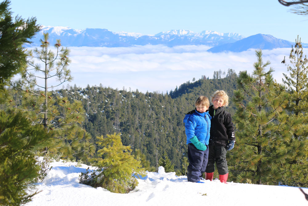
  • Walking in the Horse Mountain Area
    • Horse Mountain Mine
  • Indian Butte Loop
  • Trinity Alps Vista
  • Cold Springs Wander
  • Spike Buck Mountain
  • East Fork Willow Creek
  • Boise Creek
  • Lacks Creek
  • Pine Ridge
  • Mid-Slope Road/Pine Ridge Loop
  • Willow Creek Walks
    • Veterans Park and Camp Kimtu
    • Bigfoot Golf and Country Club Area
    • Terrace Loop
  • Brush Mountain Fire Lookout
  • “Prospect” Trail
  • Bluff Creek Historical Trail
  • Shelton Butte

Other options in the area that deserve a brief mention: Lower Bair Road

Comments

  1. Chris Valle-Riestra says

    November 13, 2019 at 1:53 am

    There is a brand new road sign marking the upper trailhead for Prospect Trail, on the Gasquet-Orleans Rd. The comment in the book about the lack of marking for this trailhead produced action! There is not yet a trail sign right at the start of the trail, at the edge of the parking lot, but one is planned. The central section of the trail has been affected by a very difficult tangle of trees from a big blowdown. One of the U.S.F.S. fire crews has been able to start work clearing it, work to be completed by Nov. 22, 2019. Trail users should understand that there is no assurance that it will be possible for the crew to clear 100% of the fallen trees this season. In particular, there is one long suspended log that runs lengthwise along the trail. It is currently necessary for hikers to walk along this log, and some may not be comfortable with this. To clear this will be a difficult, complex cut. Otherwise, most of the length of the trail, in from both the upper and lower trailheads, was cleared of most obstacles in 2017, making it easily passable. (A few logs that can be clambered over remain.) Be aware that poison oak is abundant along the top section of the trail.

    Logging out, brushing out, and general maintenance on the Bluff Creek Historical Trail were completed between 2017 and 2019. The main trail, including the switchbacks at the bottom end, mentioned in the book, is in fine condition. The extension north into the canyon of Bluff Creek (mentioned in the book) is not a Forest Service-maintained trail.

    Reply

Leave a ReplyCancel reply

Events

Join Our Newsletter

* indicates required

Our most recent Podcast

Trivia Challenge: Wildflowers of the Klamath Mountains

https://backcountrypress.com/podcast-player/21109/trivia-challenge-wildflowers-of-the-klamath-mountains.mp3

Download file | Play in new window | Duration: 19:11 | Recorded on July 8, 2022

Subscribe: Apple Podcasts | Google Podcasts | Spotify

backcountrypress

Backcountry Press
💥HOT OFF THE PRESS: Hiking Humboldt Vol. 1 (2nd 💥HOT OFF THE PRESS: Hiking Humboldt Vol. 1 (2nd edition)

58 DAY HIKES IN NORTHWEST CALIFORNIA

The 2nd edition of this favorite guide book is filled with Fresh Maps, Additional Hikes, & Stunning Photos:

• Primeval forests harboring the world’s tallest trees.

• Sea cliffs, pristine beaches, and towering coastal sand dunes.

• Mountain prairies, meadows, and vistas.

• Rivers, lakes, lagoons, and bays.

• Bears, elk, seals, otters, and birds galore.

• And solitude – lots and lots of solitude.

Humboldt County offers all this and much more to the intrepid hiker.

Hiking Humboldt Volume 1 by Kenneth M. Burton presents descriptions, directions, accurate maps (including elevation profiles), and photos of hikes that are 5-15 miles in length throughout Humboldt County, CA.

• • • • •
SALE ENDS 9/10: get the eBook for free with your paperback purchase from @backcountrypress 🙌
• • • • •

In the seven years since we published the first edition of “HHV1,” we have heard from all sorts of Humboldtians who use the book as a hiking challenge — a checklist to complete them all. We hope this 2nd new & improved edition inspires even more people to do the same. We’d love to hear about your adventures —  tag #hikinghumboldt!

Have fun out there,
Michael & Allison

📘 Pick up your copy at our L I N K or find it at your favorite local shop: @eurekabooks @booklegger_eureka @northtownbooks @eurekanaturalfoods @northcoastcoop @blakesbooksmckinleyville

(Be in touch if your shop would like to carry this title as well!)

#humboldtmade #madeinhumboldt #humboldt #humboldtcounty #eurekaca #arcata #trinidadca #ferndale #sohum #lostcoast #northerncalifornia
FRUIT FLY TRAP TEST (🪰couldn’t not nerd out o FRUIT FLY TRAP TEST
(🪰couldn’t not nerd out on this fruit season outbreak)

Was really rooting for the Pinguicula!!

(Just trying to protect the peaches, @neukomfamilyfarm! 🙏❤️)

#fruitflytrap #scienceiseverywhere #carnivourousplant #pinguicula #harvestseason
🏆 Champion Klamath Foxtail Pine! (🌲 Pinus b 🏆 Champion Klamath Foxtail Pine!

(🌲 Pinus balfouriana subspecies balfouriana)

In 2010, I first found this tree while backpacking through the Trinity Alps Wilderness in far northern California.

Just last week, thirteen years later, my 11 year old son Sylas and I returned with tools to officially measure and nominate this tree.

While points fell just short of the overall champion, it is the second largest foxtail pine known and the largest of the subspecies of the Klamath foxtail pine.

It measures 24’ circumference 84’ tall 44’ crown spread for 383 AF points.

(I know what you’re thinking, but that actually stands for American Forest points. 🙃)

Tap our L I N K for the full story and learn how to measure a tree.

Klamath foxtail pines exist above 6500’ in the Klamath Mountains, often on serpentine soils. Find the one spot in this region you can actually drive to one in our book Conifer Country.

Foxtail pines are relatives of the Great Basin bristlecone (Pinus longaeva) and Rocky Mountain bristlecone (Pinus aristata). However, foxtail pines are endemic to California’s Sierra Nevada and Klamath Mountains. 

The best way to see this species is to hike to them. This particular tree required my son and I to do a 30 mile backpacking trip. It was full of wonder and beauty!

- @michael.kauffmann 

#foxtailpine #pinusbalfouriana #klamathmountains #conifers #conifercountry #californianativeplants #endemic #serpentine #pnw #pnwonderland #backpacking #trinityalps #wilderness #likefatherlikeson #treemagic #bigtree
🤩🎉🤩 You’re looking at the @northcoastjo 🤩🎉🤩 You’re looking at the @northcoastjournal’s pick for Best Local Author with the proprietor of the Best Bookstore @booklegger_eureka: @michael.kauffmann & Jen McFadden!

Such an honor, thank you all for your support! I know creating an account to vote was an annoying little hurdle, so extra thanks for leaping over it to cast yours! 💙

Also, how about the @cityofeureka’s Friday Night Market?! Talk about a vibrant little city by the sea!

#thankyou #iloveeureka #eurekacalifornia #independentbookstore #independentpublishing #humboldtcounty #humboldt #madeinhumboldt #humboldtmade
💎Orchid garden along the Smith River’s South 💎Orchid garden along the Smith River’s South Fork💎

The Smith is the most undeveloped and protected river remaining in California, and the largest completely undammed river from source to sea in the state. Much of the watershed features serpentine formations of the Josephine Ophiolite, and large areas are suited to rare plant life that thrives in harsh settings and in soils containing metals and minerals that are not conducive to typical forest growth.

The South Fork comes from higher elevations of the Siskiyou Wilderness where snow melt lingers and contributes to the basin’s highest flows through the spring.

Much of the Smith’s quality is attributed to nearly all the watershed being in public ownership as the Smith River National Recreation Area with legislated priorities on land and water protection. In addition, all of the 18 mile main stem and 320 miles of tributaries were designated as National Wild and Scenic Rivers in 1981.

This marked the first time that the streams of virtually an entire river basin were together designated in the National Wild and Scenic Ricer System as part of a watershed-wide approach.

💎 Stream Orchid, AKA Chatterbox (Epipactis gigantea)

Where have you found these stunning (and well camouflaged!) orchids blooming this summer? They’re surprisingly common, though often go unnoticed because they blend in so well with their surroundings. 

Featured 📕: Wildflowers of California’s Klamath Mountains

#wildandscenic #orchid #californianativeplants #serpentine #smithriver #klamathmountains #wilderness #wildcalifornia #delnortecounty #northerncalifornia
It’s our somewhat annual SCRATCH & DENT SALE!

💥 Check out a selection of books SLIGHTLY damaged in the shipping process. Deeply discounted and 100% useable.

🔎 Honestly, you may not even notice they’re damaged.

🔗 See what’s available at our L I N K

🤍 These deals brought to you by our favorite flowering native plant of the day: Lewis’ Mock Orange (Philadelphus lewisii). Intoxicatingly fragrant and beautiful.

#californianativeplants #mockorange #manzanita #naturalhistory #botany #naturenerd #nativeplants
Load More... Follow on Instagram

Product tags

Botany Butterflies California Conifers Desert ecology ectotherms explorations Fire Fire Ecology Forest pathogens Fungi Geology Hiking Hiking Guide Humboldt County Identification Card Invertebates Klamath Mountains Klamath Mountians Lassen Volcanic National Park Literature Mammals Natural History Oregon Pacific Crest Trail pathogens Pines Plant Exploring Plants redwood forest Rivers road guide Seaweed Trinity Alps Washington

GIft Card from BCP

bookstore

Subscribe to the Backcountry Press Blog

Enter your email address to subscribe to this blog and receive notifications of new posts by email.

Join 221 other subscribers

FREE SHIPPING on orders of $75 or more Dismiss